
Forging ahead on my National Park hunt, I made the choice to stop at the Grand Canyon. The National Park Service has created collectable tokens for National Parks, National Monuments, National Historic Sites, etc. I started collecting them last September with my first one being from the Dry Tortugas National Park. I was so close to the Grand Canyon, and having been there before, I thought I could stop at the visitor center and pick one up. I ended up spending the majority of the day hiking along the South Rim.
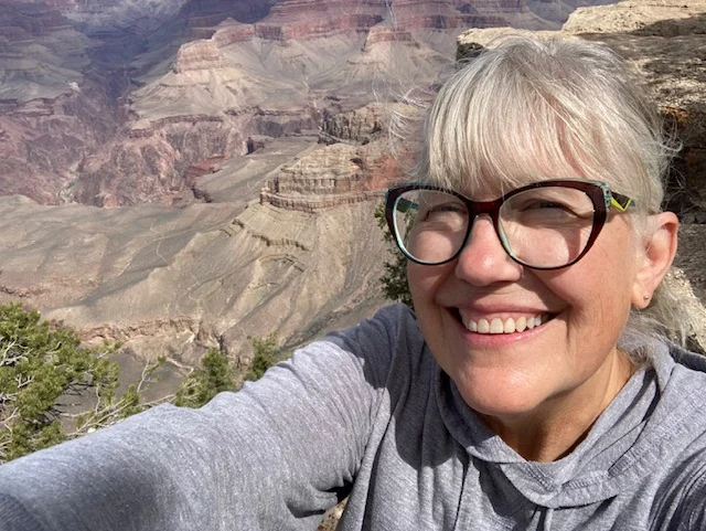
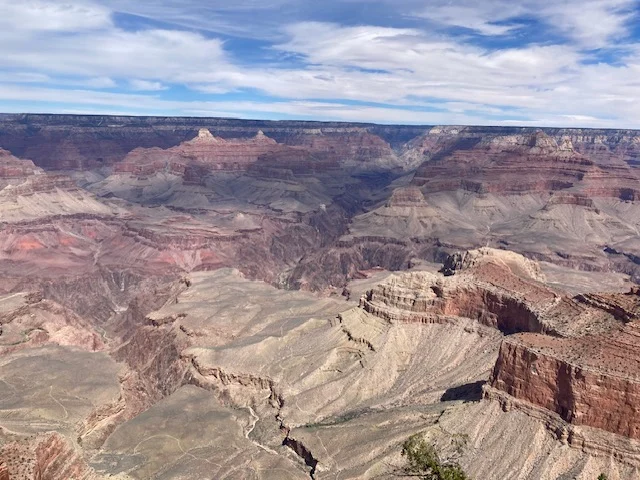
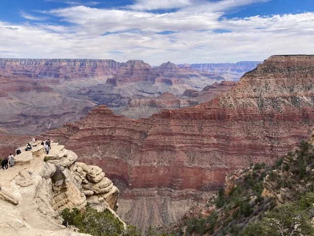
I am so glad I chose to stay and hike the rim! The vastness of the canyon is indescribable! The awe it inspires, and the realization of how insignificant one human being is within its walls is striking. As a detail-oriented person, the striped canyon walls and variety of colors are gorgeous to me!
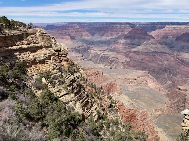
It was a busy day at the canyon, with lots of people admiring the vistas, shopping in the stores, learning about the geology and investigating the history.
The park protects 1,904 square miles of wilderness and runs 277 river miles. The canyon was first seen by Europeans in 1540, though there is evidence that Indigenous people lived in the area, or passed through, thousands of years ago. The first European settlements started on the South Rim in the 1880s, and a railroad spur made it easier for tourism in 1901. A hotel, the El Tovar Hotel, was opened in 1905 as a destination hotel and is still running today. Other buildings from that era are still being used in the Grand Canyon Village.
The canyon was first protected in 1893 by President Benjamin Harrison renaming it Grand Canyon Forest Reserve. President Theodore Roosevelt designated it a national monument in 1908 and it became Grand Canyon National Park in 1919. President Woodrow Wilson designated it a national park to protect the land and the resources within the canyon. It was declared a World Heritage Site by the United Nations in 1979.
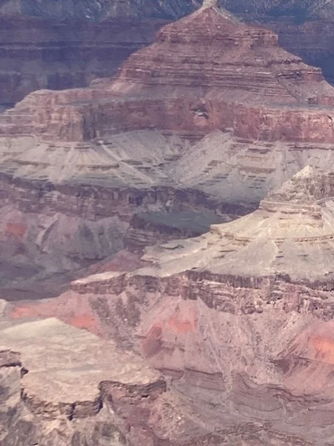
The rim is capped by 258-million-year-old limestone, while one mile down the Vishnu schist is about 1.75 billion years old. I found it interesting that recent studies suggest that an eastward-flowing paleo-river carved most of the western part of the canyon 70 million years ago, while a different river formed the eastern section 55 million years ago. The Colorado River joined the rivers and finished the canyon with sections it carved itself.
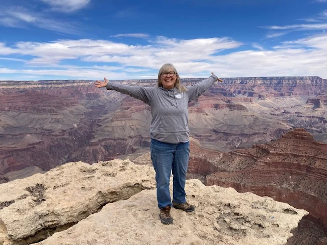
There are many overlooks on the limestone cap along the rim, some with rails and others I think were more created by visitors than the park. Several stretch out from the rim into the canyon. One such limestone outcropping is accessed by a short challenging trail climbing down over rocks and following a narrow path along the canyon wall. I did it!
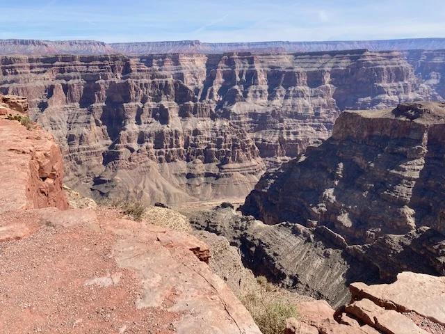
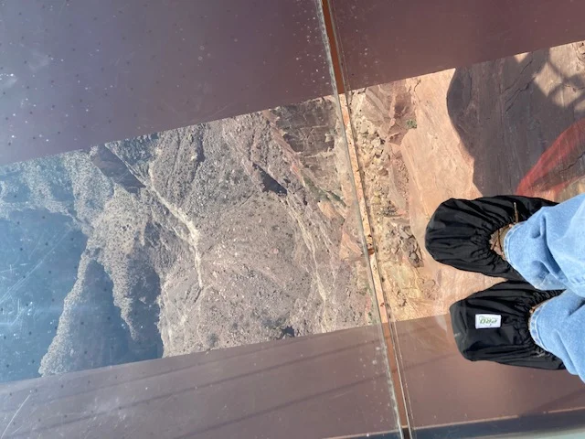
About a 5-hour drive to the west is Grand Canyon West. It is not part of the National Park and is located on Hualapai tribal lands. The last time I was at that location, they were in the process of constructing the Skywalk, a horseshoe shaped steel frame with a glass floor and sides that projects about 70 feet from the rim out over the canyon. One of my sons visited the site after the Skywalk was completed and sent me a photo taken that looked like he was in the air in the canyon. I have wanted to visit the Skywalk since, so the next day I headed over to the Grand Canyon West.
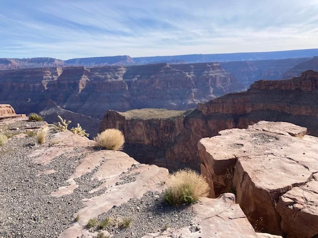
The main difference, to me, between the western side of the Grand Canyon and the South Rim is the closeness of the canyon walls. It is easier to see the other side of the canyon and the different colorful layers.
Standing on the glass, looking down, watching cave swallows flying below me was incredible!
The only way to get to the Skywalk is by shuttle, and the shuttle route has several different stops with points along the rim. Education about the culture also is available at different points.
I ate lunch at the Sky View Restaurant – a stew and flatbread – perched two stories above the Skywalk. Birds eye view was a reality. Large black birds rode the wind right outside my window, and then dove straight into the canyon.
Guano Point, one of the shuttle stops, offers a panoramic view of the canyon. Beyond the breathtaking scenery is the history surrounding the point. In 1930, a guuano cave was discovered on the south side of the canyon wall. Guano, which is actually bat droppings, is a valuable fertilizer rich in nitrogen. By 1957, the U.S. Guano Corporation invested $3.5 million to extract the guano, constructing a massive aerial tramway spanning 7,500 feet across the canyon. That tramway, with a 2,500-feet vertical lift, connected the cave to what is now Guano Point. For nearly two decades, workers and guano would ride it across the canyon. Parts of the tramway still remains.
The skeleton of the tramway creaked and squawked in the high winds the day I was there. I couldn’t imagine riding across the canyon in a tram!