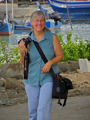
The last two National Parks I visited in Texas were Big Bend National Park, located in southwest Texas along the Rio Grande River, and Guadalupe Mountains National Park, located in western Texas on the border of New Mexico.
I’ll start with the 801,163-acre Big Bend National Park. The name is appropriate because of the big U-turn made by the Rio Grande on the south border of the park, which also is the border between the United States and Mexico. The Santa Elena, Mariscal, and Boquillas canyons and the areas around them became the Texas Canyons State Park in the 1930s. later named Big Bend State Park. It became a National Park presented as “Texas Gift to the Nation” in 1944 after the Chisos Mountain range was added to the protected land.
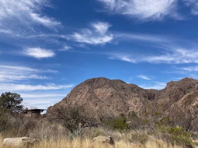
Driving into the park, there is a huge variety of plateaus, hills, mountains and flatness. Honestly, I don’t much care for deserts. Driving through the deserts in Texas and New Mexico, I see individual homes or small neighborhoods of three or so houses in the middle of nowhere surrounded by flat sandy land with sparse vegetation and wonder why anyone would want to live there. That probably comes from growing up in lush green areas with lots of water and trees.
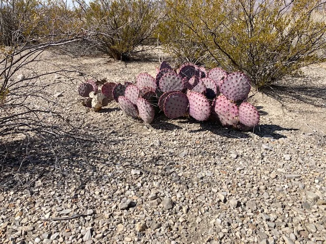
Anyway, I have learned that there is so much beauty in the desert, if one takes the time to stop and look. This journey has given me a better appreciation for the desert and how it works. At Big Bend there is beauty in the layers of color, like the striped reddish brown in a sea of golden tan in a pyramid shape, or the clouds and sun striping the desert mountains, or the purple prickly pear cactus surrounded by golden sand and brown or green cactus.
One thing that is interesting to me is the wind playing with the sand and creating dust devils, little rotating columns of sand that dissipate as they get higher. I saw several of those individually in the distance, some larger than others.
A magnificent view in the park is the Sotol Vista, where one can view the Chisos Mountains behind a large swath of the Chihuahuan Desert. Accessing the vista, one drives a razor back road with drops on both sides, and the view is worth the drive, even if you have height issues. Sitting on a bench at the overlook, I let the wind, lots of gusty wind, rock me and wash away any tension in my body.
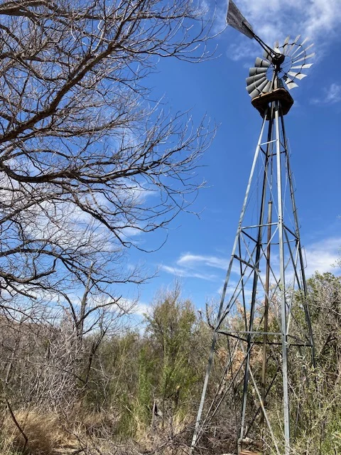
Besides the beauty, there is a lot of history in the park. One area is the remnants of the Sam Nail Ranch, established in 1916, where one of the windmills still brings water to the surface watering the nearby trees and vegetation.
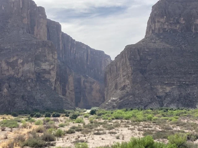
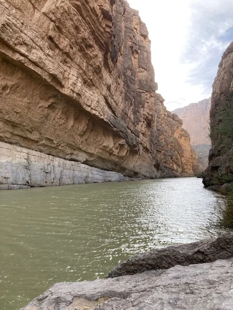
One of the most popular hikes in the park leads into the Santa Elena Canyon, where 1,500-feet sandstone walls reach to the sky from the Rio Grande River. A switch back trail leads up the mouth of the canyon and then back down to a path along one side of the river. The trail is about 3/4-mile long, ending where the canyon wall drops directly to the water.
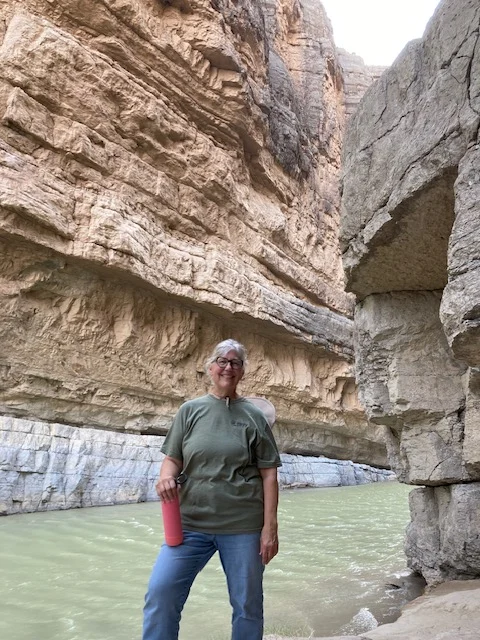
And, of course, I had to put my hand in the Rio Grande River!
Leaving Big Bend I drove back roads through the middle of nowhere toward the Guadalupe Mountains National Park. I was surprised that I was stopped at a Border Patrol stop because I hadn’t run into that before. I asked why the stop was located there, and the officers said because of smuggling. One of the officers said they patrol within 100 miles of the border. I stopped to sleep in Van Horn, and I noticed more border patrol vehicles between there and Guadalupe Mountains National Park. I thought that was interesting.
The views on the drive to Guadalupe Mountains National Park were amazing! The rock monuments, plateaus, cliffs, desert mountains were all beautiful. I really am enjoying the breathtaking and awe inspiring views as I drive.
While the idea of preserving the area around Guadalupe Mountains began in the 1920s, it wasn’t until 1959 when Geologist Wallace Pratt donated 6,000 acres of McKittrick Canyon to the National Park Service that the nucleus of the future park was identified. Congress passed a law to preserve the Guadallupe Mountains outstanding geological and scenic values in 1966, but it was not until 1972 that all the land transfers, including the purchase of 80,000 acres from J.C. Hunter Jr., were completed and the park was officially dedicated. The Frijole Ranch was included in that 80,000-acre purchase.
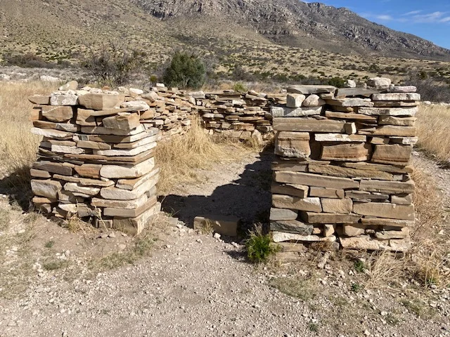
The first thing I did was a short hike around the visitor center. Really, a forced hike. The parking around the visitor center was full, but there was another small lot that was directly near the remnants of the stagecoach stop at Pinery Station. You could walk the trail from there to the visitor center. I don’t think I mentioned this before, but the visitor centers are very important to me. I started collecting the National Park tokens when I visited the Dry Tortugas, so one of my first stops at each National Park is the visitor center to pick one up. It’s interesting that they are different at different parks. Most of those I have collected are round, but now I have two that are rectangles. And the prices are different. One I got for free, and the rest have ranged from 99 cents to $1.99. I digress…
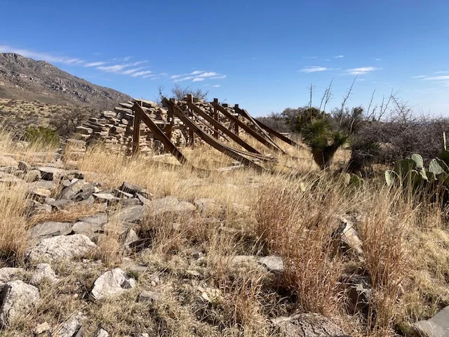
The Pinery Station was one of the Butterfield stations, which were located an average of 20 miles apart. It was used for 11 months starting in September 1858. Coaches stopped regularly for food, water, rest, fresh mule teams and protection. The limestone walls continued to provide refuge for a variety of people long after the station was abandoned.
As you can tell from my previous posts, I am fascinated by history. Learning about our history, whether our direct history or the history of a different part of the country or even of a different country, helps us know where we came from and gives a better understanding of why people have done what they have done.
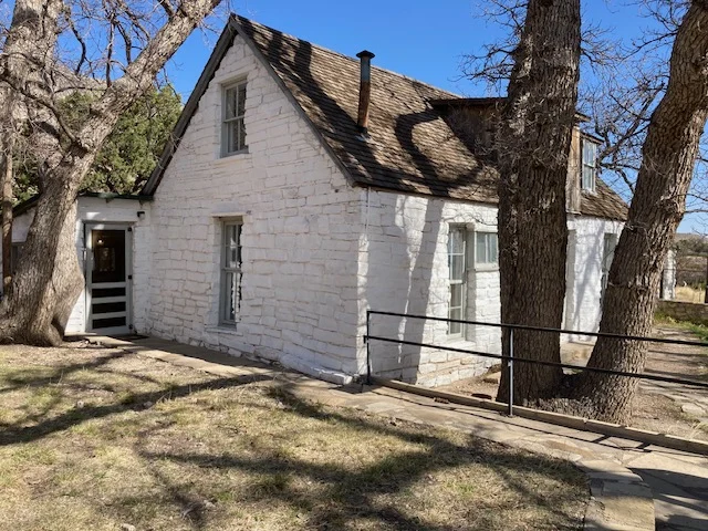
The history around the Guadalupe Mountains is fascinating. Like the Frijole Ranch Cultural Museum nestled at the base of one of the mountains. The museum is located inside the original home of the ranch headquarters and displays the sequential human history of the Guadalupes from the Native Americans on. The first part of the home was a two-room structure built in 1876. It was expanded both adding rooms on the back and a second story in the 1920s. The location was special because of three springs located within a 2-mile radius of the ranch. It is unusual to have three springs in such close proximity. The geology of the Guadalupe Mountains, and the springs in such close proximity to each other contributed to the area becoming part of the National Park.
One of the springs, the Frijole Spring, is within 40 feet of the house, and narrow ditches were created, like a mini aqueduct in the ground, to bring spring water to the orchard where over the years apples, peaches, apricots, plums, pears, figs, pecans, blackberries, strawberries, currants, and some corn were grown.
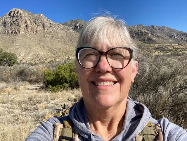
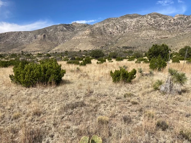
I hiked to where the Manzanita Spring was once dammed and a pond created. What fascinated me was the number of bushes, which looked like a type of cedar, that dotted the desert with the mountains rising behind them.
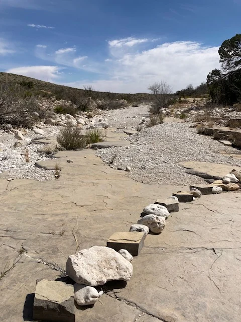
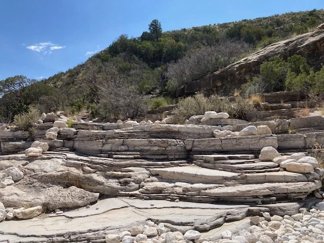
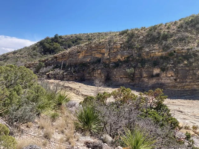
My last stop before leaving the Guadalupe Mountains was hiking the McKittrick Canyon. Feeling a little under the weather that day, I only went in about 3/4 mile and back. The hike was different than any of the other hikes I had done. The northeast wall of the canyon is part of the Captain Reef, a fossilized reef formed millions of years ago. The creek bed is porous, and now parts of the creek have seeped under calcite that has collected over many many years. I crossed the dry creek bed several times before walking the trail alongside.
I wasn’t sure I was going to stop at Guadalupe Mountains National Park, but I’m sure glad I did! Even though I was a little under the weather and didn’t take on any challenging hikes, I was able to see a variety of landscapes and learn more about the history of the area.